(Click on the figure to get a bigger version)
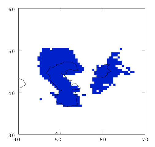
Geomorphic evidence indicates that the Aral and Caspian Seas were much expanded at the last glacial maximum. This gridded dataset shows the extent of these lakes at 0.5 resolution, based on the work of Kvasov (1975a, 1975b) which indicates a lake level rise of +74m.
(Click on the figure to get a bigger version)
| Full size image (17 Kb) |
| pdf file (51 Kb) |
| Data file - zipped text file (1 Kb) |
| Data file - gzipped text file (1 Kb) |
If you wish to use this data set as a mask for LGM simulations, please cite Prentice et al. (1993) as the source. Please note, there is new data which suggests that the extent of these lakes may have been somewhat smaller than implied by the information given in Kvasov (1975a, 1975b). A new data set is currently being prepared and will be included on this website in the near future.
Technical queries about the data sets should be addressed to Sandy Harrison.