The third beta version of the river data set (beta 3) has
been temporarily taken off-line and is being checked.
Any problem should be immediately reported to Sandy Harrison, Michael Coe, Kerstin
Sickel and Jean-Yves Peterschmitt.
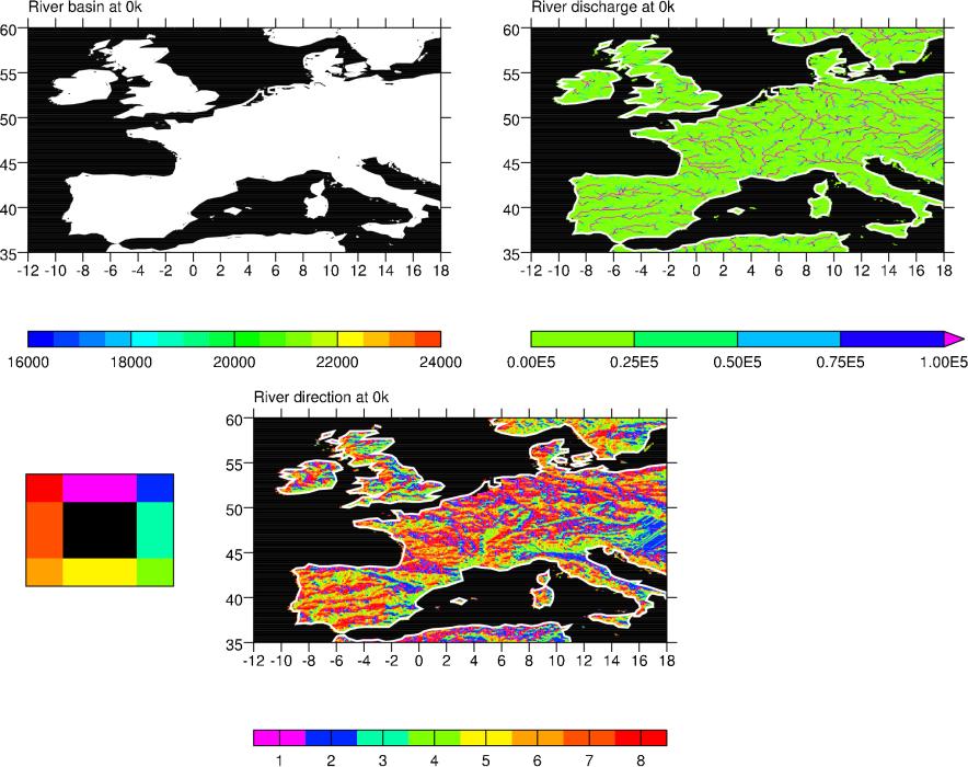
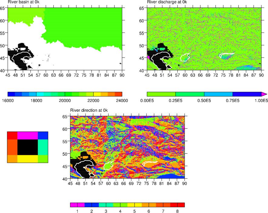
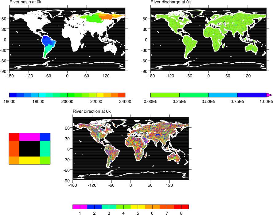
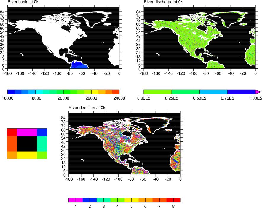
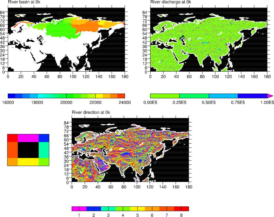
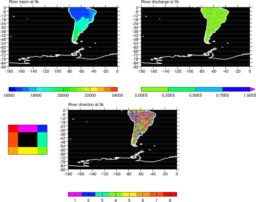
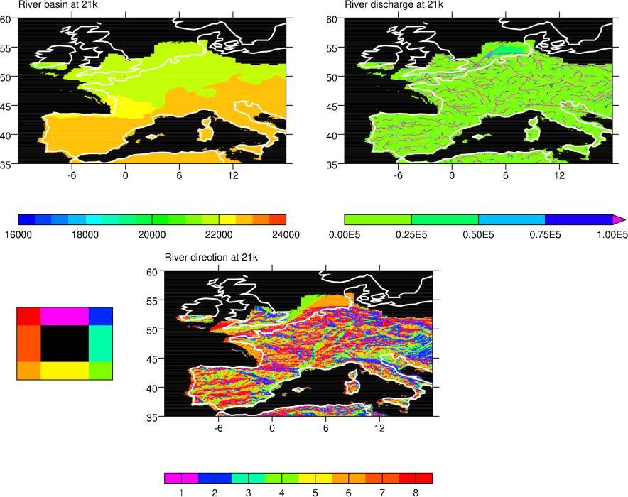
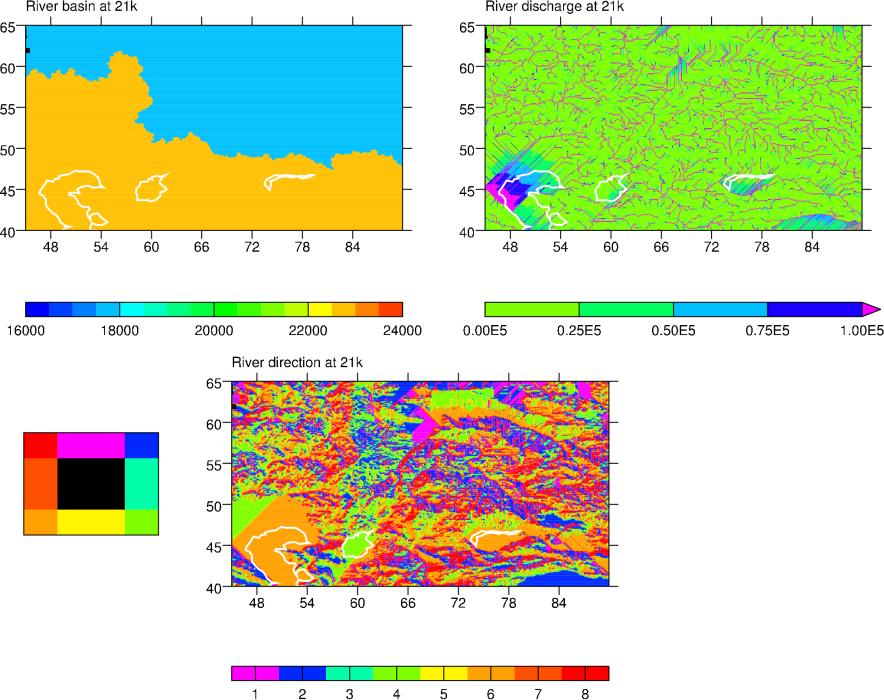
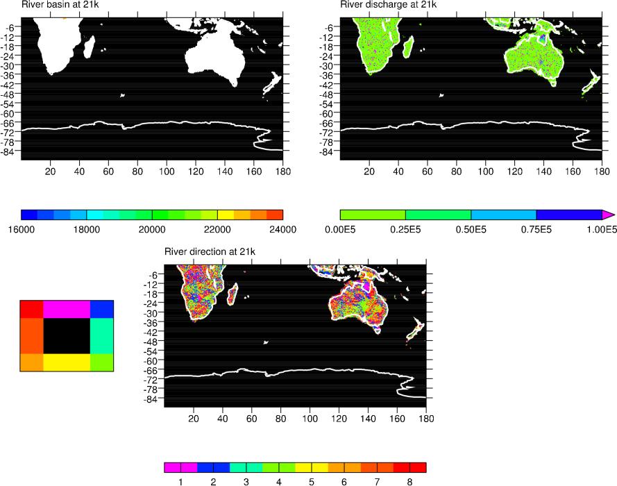
The data sets were produced with the HYDRA river routing model with
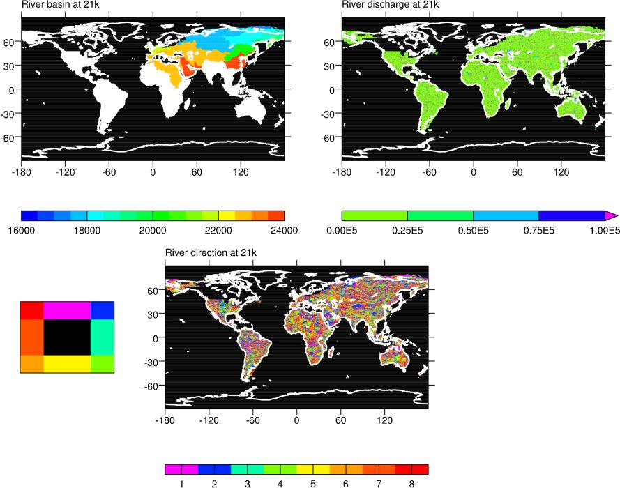
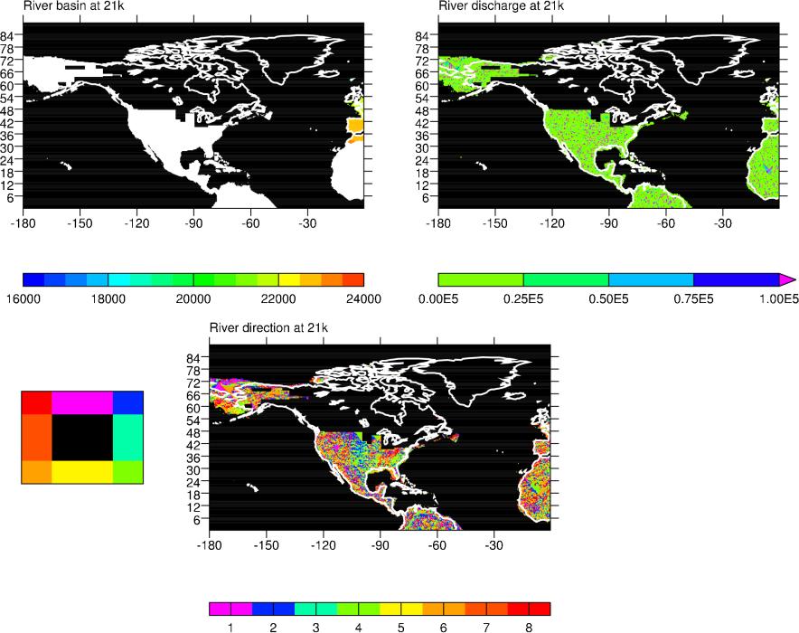
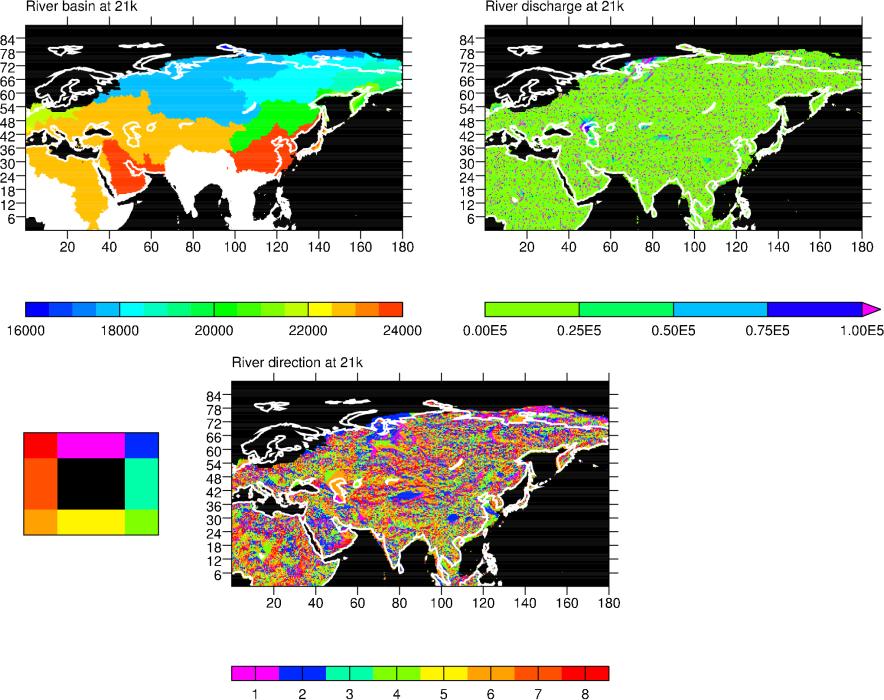
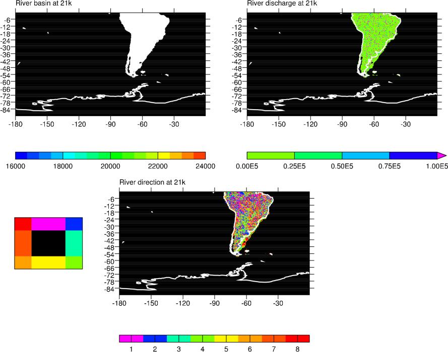
unlimited runoff in order to determine potential river routes. The
model predicted river direction, river routes and river basins.
Please note that the HYDRA simulations produced many more rivers and
river basins than what is commonly incorporated in climate
models. This information was not reduced because it was not yet clear
what would be most useful to do...
The modern topography that was used is different from the one used
by W. R. Peltier in ICE-5G. It was produced by combining several
different 5-minute Digital Elevation Models, using the best one for
each region to ensure a reasonably correct simulation of the modern
drainage network.
The LGM topography was then generated by applying the 21ka-0ka
topographic anomaly from the ICE-5G
data set to the modern data set. The land-ice was then overlaid as
a mask on this topography.
The directions of the rivers stored in the river_dis_[0,21]k.nc use the following convention:
| NW = 8 | N = 1 | NE = 2 |
| W = 7 | E = 3 | |
| SW = 6 | S = 5 | SE = 4 |
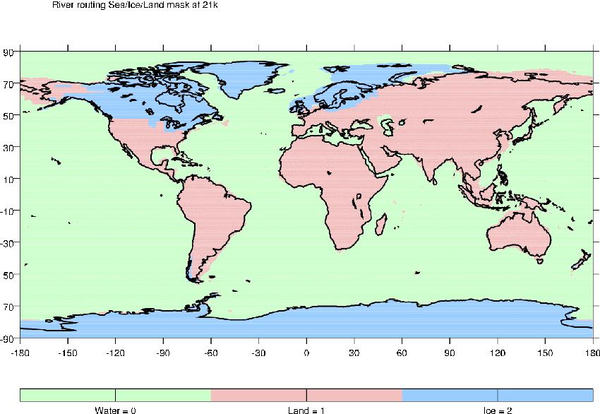
The mask is on a 5-minute grid and uses the following convention:
| Water = 0 | Land = 1 | Ice = 2 |
The procedure for generating the data sets will be fully described in a paper that is currently in preparation. Until the reference is available, please cite the data as:
| Harrison et al., in prep |
The data files are provided on a 5-minute grid (4320x2160 points)
in netCDF format (note that their name and internal structure may
still evolve a bit...).
If you have technical questions about the data files, please get in
touch with Kerstin Sickel and Jean-Yves
Peterschmitt.
[10/20/2004] Warning!
The third beta version of the river data set (beta 3) has
been temporarily taken off-line and is being checked.
| 0K | 21K | ||
| River direction | river_dir_0k_b3.nc.gz | river_dir_21k_b3.nc.gz | |
| River discharge | river_dis_0k_b3.nc.gz | river_dis_21k_b3.nc.gz | |
| River basin | river_bas_0k_b3.nc.gz | river_bas_21k_b3.nc.gz | |
| Quick look |
Europe_0k
Zone2_0k World_0k World_NW_0k World_NE_0k World_SW_0k World_SE_0k |
Europe_21k
Zone2_21k World_21k World_NW_21k World_NE_21k World_SW_21k World_SE_21k |
|
| Sea/Ice/Land mask |
river_sil_mask_21k_b3.nc.gz
(84 Kb) |
||
| Quick look | X | ||
| All the gzipped data files in a single tar file | pmip2_river_data_b3.tar | ||
| All the gzipped quick-looks in a single tar file |
pmip2_river_quicklooks_b3.tar
(1.5 Mb) |
||